Geodetic Coordinates
Advertisement
GeographicLib v.1.22
Geographic conversion made easy. GeographicLib is a small set of C++ classes for performing conversions between geographic, UTM, UPS, MGRS, geocentric, and local cartesian coordinates, for geoid height calculations, and for solving geodesic problems.
Advertisement

GeoGPS v.1.3.0.0
Turn your Windows Phone to a full-featured hand held GPS device with this App. Designed for navigation, finding directions and planning outdoor activities or at sea. Suitable for work with paper charts and plans even beyond WGS84. • Set waypoints
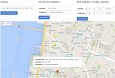
GPS Coordinates v.1.0
Get or share GPS coordinates, address, and Latitude and Longitude. Latitude and longitude Finder Convert any address or place to lat long. Address Finder Find any address from its GPS coordinates.

Find Distance Between Multiple Latitude and Longitude Coordinates Software v.7.0
This software offers a solution for users who want to find the distance between one or more latitude and longitude coordinates. Coordinates can be added one at a time or loaded from a text file.
Equatorial Coordinates Model v.1.0
Analyze star position with this application. Equatorial Coordinates model displays the position of a star in equatorial (Right Ascension/Declination --- RA/Dec) coordinates. The horizon is shown along with the four cardinal directions (N, E, S,
Local Coordinates Model v.1.0
Displays the position of a star in local (Altitude/Azimuth) coordinates. Local Coordinates model displays the position of a star in local (Altitude/Azimuth) coordinates. The horizon is shown along with the four cardinal directions (N, E, S, and W).
Open geo coordinates database v.1.0
At the current state, opengeodb provide geo coordinates and several other data (city name, zip) mainly for the german speaking area.
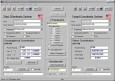
AllTrans
AllTrans can be used for world wide professional coordinate transformations between international and national coordinate systems with or without geodetic datum change. Transformations between State-Plane-Coordinates (NAD83, NAD27, Transverse Mercator,
Geoida v.1.0
Geoida is a software product that will benefit members of the surveying and related professions for the day-to-day routine processing, coordination and adjustment of spatial survey data, from routine pick-up surveys to complex networks of geodetic sc
Seismic Datum Converter v.3.0
This program is designed to convert segy file trace header coordinates from one datum to another datum and/or from one UTM zone to another one. It accepts as input geodetic (rectangular) coordinates written in segy trace headers,

SEVENPAR v.8.01
SEVENPAR calculaties exact parameter sets for the Spatial Helmert or Molodensky Transformation with seven or three parameters, which are used for accurate geodetic datum shifts between different reference systems for coordinate transformations.